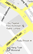
How to go to Hang Tuah Bus Terminal, Kuala Lumpur? Live Area Map, Roads and Directions
 Hang Tuah Bus Terminal in Kuala Lumpur caters for short distance express bus operations to Seremban and Tanjung Malim during the closure of the Puduraya Bus Terminal for renovations. The Hang Tuah Bus Terminal is located next to the Kuala Lumpur Contingent Police (PDRM KL HQ) office near Jalan Galloway and is 2ha in size.
Hang Tuah Bus Terminal is equipped with 120 parking lots for buses and around 260 motorcycle parking spaces with a building complete with facilities such as waiting areas, trading areas, toilets, canteen and prayer rooms.
There are also stations of various public transport modes nearby such as the Hang Tuah LRT and Monorail, RapidKL feeder buses and taxis in the area.
Hang Tuah Bus Terminal Live Area Map and Directions
To get driving direction to Hang Tuah Bus Terminal, click “Directions” in the map marker. Fill up point “A” and “B” box below the map. Click “Get Directions” and you will get the route and direction instructions below the map.
Example: If you are coming from Bangsar to the place marked here, click “Directions”, there are point “A” and “B” destination box below the map. Type “Bangsar” in point “A” box and click “Go”.
