How to go to KL Tower (Kuala Lumpur Tower), Kuala Lumpur? Live Area Map, Roads and Directions
 The Kuala Lumpur Tower (officially known as Menara Kuala Lumpur; referred later as KL Tower) is a tall tower located in Kuala Lumpur, Malaysia. Its construction was finished in 1 January 1990. It is used for communication purposes and features an antenna that reaches 421 m (1,381 ft), which currently makes it the eighteenth tallest freestanding tower in the world. The roof of the pod is at 335 m (1,099 ft). The rest of the tower below has a stairwell and an elevator to reach the upper area, which also contains a revolving restaurant, providing diners a beautiful view of the city. Races are organised yearly where participants race up the stairs to the top. The tower also acts as the Islamic falak observatory to look for the crescent moon to mark the beginning of Muslim month of Ramadhan, Syawal, and Zulhijjah, to celebrate fasting month of Ramadhan, Hari Raya Aidilfitri and Aidiladha.
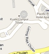
KL Tower (Kuala Lumpur Tower) Live Area Map and Directions
To get driving direction to KL Tower (Kuala Lumpur Tower), Kuala Lumpur, click “Get Directions” in the map marker. Choose “from here” or “to here” box and type the other location you are coming from/going to. Click “Go” and you will get the route and direction instructions below the map.
Example: If you are coming from Bangsar to the place marked here, click “Get Directions”, make sure “to here” is selected. Type “Bangsar” and click “Go”.
