Where Is KLIA2 Airport Located?
KLIA2 is Malaysia’s new International Airport Hub that seamlessly connect both local and international low-cost and full-service carriers which is designed to cater 45 million passengers a year and replaces the Low Cost Carrier Terminal (LCCT) from May 2014.
KLIA2 is located less than 2km away from KLIA. With an Express Rail Link extension being constructed to connect KLIA to KLIA2, this enables easier and more convenient transit travels for passengers.
KLIA2 is well connected via highways and can be accessed via the following highways:
- ELITE Highway
- KESAS Highway
- LDP Highway
- MAJU Expressway
- New Klang Valley Expressway (NKVE)
- North South Expressway Central Link
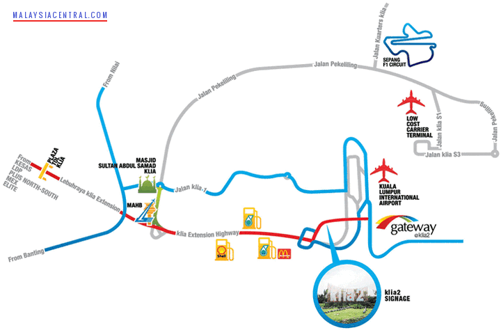
The map below shows KLIA2 (gateway@klia2) near KLIA and LCCT. Once you pass Petronas petrol station, keep left and exit when you see a flyover with KLIA2 signage.
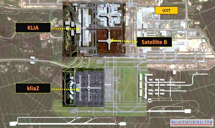
 KLIA2 is built just beside KLIA and it is easier to go there unlike the LCCT where you have to use a long road going around the airport land. The map below shows the location of KLIA2 in a satellite image.
Distance from KLIA to KLIA2 is around 2km.
Distance from LCCT to KLIA2 is around 16km.
The GPS coordinates for KLIA2 is 2.758819, 101.689698.